Historical Resource Estimate: 6.4 million tonnes of 0.462% WO3 using a 0.2% WO3 cutoff (Noncompliant).*
A total of 59 drill holes with an aggregate length of 9,468m currently recorded.
Re-log and sample core, focus on veined intrusion.
UAV drone magnetic survey
YMC owns 100% of the 900-hectare property.
In-house drone survey for topography and imagery.
Ownership & Scale
YMC owns 100% of the 900-hectare property.
Location
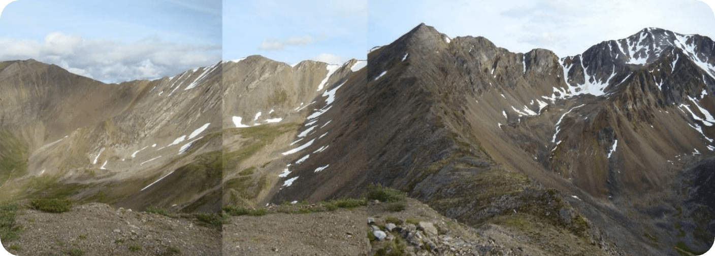
35km southwest of Ross River.
25km trail to access the Old Canol Road, used in previous drill campaigns
Permitting
First Nations Consultation.
Class 1 Permit: Summer 2025.
* Reported by Playfair Mining Ltd., 2007. This is a historical estimate as defined by NI 43-101 and should not be relied upon. A Qualified Person has not done sufficient work to classify the historical estimate as a current mineral resource, and YMC is not treating the historical estimate as a current mineral resource
Gallery
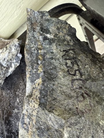
float sample k155003 of oxidized vein found in a new area in the central part of the az claim block
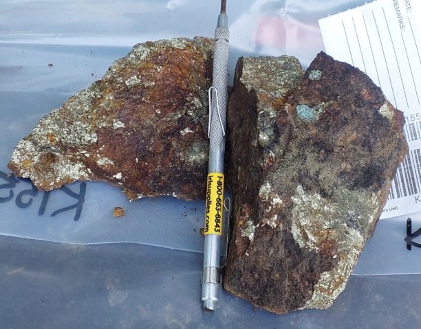
sample k155053 from outcrop exposure near drill hole az25-004 intensely altered diorite with band of chalcopyrite minor bornite and pyrite
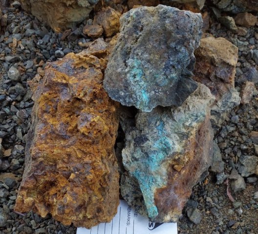
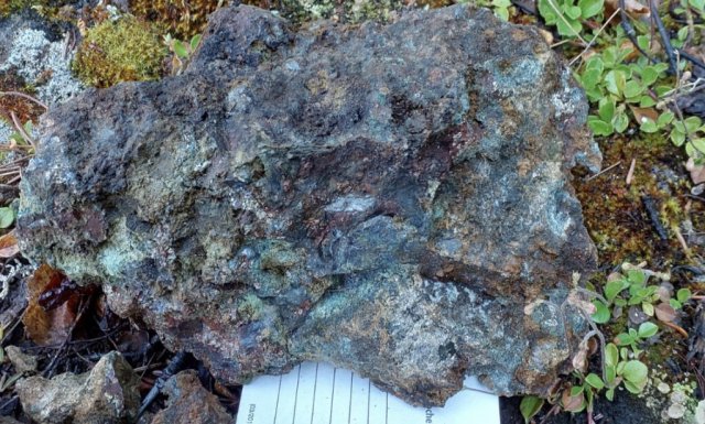
sample k155456 from the az skarn occurrence
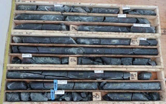
altered diorite intersected in az25-004 located at the new target zone. partially hematized magnetite visible along with disseminated and veined pyrite-minor chalcopyrite throughout
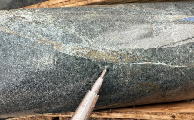
altered diorite with pyrite and chalcopyrite in veining and disseminated from az25-004 at 135 metres
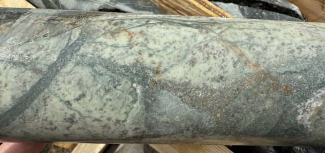
diorite with quartz-pyrite-chalcopyrite veining at 51.7m in hole az25-004
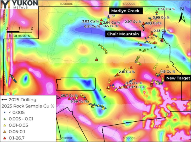
map showing 2025 az property-wide rock-chip samples with tilt derivative of the reduced-to-pole magnetic field shaded colour contour map
sample k140134 in historical trench at marilyn creek